Jervis Bay is a popular tourist destination on NSW south coast. It boasts powder-white sands, crystal clear waters, extensive areas of intact native vegetation and plenty of opportunities for recreational activities, including diving, snorkelling, boating, fishing and whale watching.
The area has significant Aboriginal cultural and heritage value, including the Booderee National Park, which is managed by the Wreck Bay Aboriginal community in collaboration with Parks Australia.
Jervis Bay is also home to one of Australia’s largest commercial mussel-growing leases.
Water quality
Jervis Bay has not been sampled as part of our monitoring program. We monitor water quality in Carama Creek, Wowly Gully, Callala Creek, Currambene Creek, Moona Moona Creek, Flat Rock Creek and Captains Beach Lagoon, almost all of the main tributaries to Jervis Bay.
Currambene Creek was last sampled in 2017–18 with the other tributaries last sampled in 2011–12.
As part of our Beachwatch program we assess swimming suitability at one swimming site in Jervis Bay using microbial indicators. Shoalhaven City Council collect samples at each site weekly between December and February to calculate the suitability grade. Sampling is ongoing. The grade reflects the most recent 56 water quality results to February 2021. Find out more about how we monitor beach water quality.
| Local government area | Swim site name | Grade |
|---|---|---|
| Shoalhaven | Collingwood Beach | Very good |
Collingwood Beach usually has excellent microbial water quality. It has few potential sources of faecal pollution and water is considered suitable for swimming almost all of the time.
Water can sometimes be unsuitable for swimming, especially after rainfall, when stormwater and wastewater can overflow into swimming areas. Learn more about what the grades mean and how we grade swimming sites on the Beachwatch How we report webpage.
Water sampling and laboratory analysis were funded by Shoalhaven City Council.
Physical characteristics
| Estuary type | Bay |
|---|---|
| Latitude | –35.1 (ºS) |
| Longitude | 150.79 (ºE) |
| Catchment area | 32.4 km2 |
| Estuary area | 123.9 km2 |
| Estuary volume | 1,197,7656.3 ML |
| Average depth | 16.2 m |
Notes: km2 = square kilometres; m = metres; ML = megalitres.
Water depth and survey data
Bathymetric and coastal topography data for this estuary are available in our data portal.
Land use
The Jervis Bay catchment has a low level of disturbance, with large forested areas conserved by national parks. A number of low- to medium-density residential areas and associated amenities occur along the coastline. Over time the area has supported an array of industries, including grazing, dairy farms, fishing, timber extraction, ship building, whaling, naval training and tourism.
National and marine parks
- Booderee National Park is the largest conservation area in the Jervis Bay catchment.
- Jervis Bay National Park also protects a conservation area around Jervis Bay.
- Jervis Bay Marine Park is associated with this estuary.
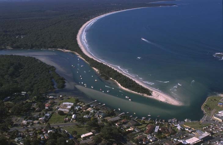
Aerial view of Jervis Bay
Seafood harvest area status
The NSW Food Authority website lists the current status of oyster/shellfish harvest areas.
Local government management
Local councils manage estuaries within their area unless the estuary is attached to a marine park. This estuary is located within the Jervis Bay Marine Park and is managed by Shoalhaven City Council.
Threatened species
This estuary provides habitat for the critically endangered eastern hooded dotterel.
Read more about the biodiversity in our estuaries.