Corindi River estuary is a barrier river estuary on the north coast of New South Wales. It enters the ocean at the township of Red Rock. The largest tributary into the estuary is Saltwater Creek, which flows from the north west through Yuraygir National Park.
There are vast tidal flats around the estuary entrance which provide critical shorebird habitat as well as recreational value to visitors and residents of Red Rock. Mangrove and saltmarsh communities are widespread in the estuary.
Water quality report card
As part of our water quality monitoring program we assess the water quality and ecosystem health of an estuary using a range of relevant indicators. We sample a subset of the estuaries located between the Queensland border and Taree every 3 years. The most recent sampling in Corindi River was completed over the 2021–22 summer, when 2 sites were sampled on a monthly basis.
This report card represents 2 water quality indicators that we routinely measure: the amount of algae present and water clarity. Low levels of these 2 indicators equate with good water quality.
Algae
Water clarity
Overall grade
The report card shows the condition of the estuary was good with:
- algae abundance graded good (B)
- water clarity graded good (B)
- overall estuary health graded good (B).
Grades for algae, water clarity and overall are represented as:
- A – excellent
- B – good
- C – fair
- D – poor
- E – very poor.
Go to estuary report cards to find out what each grade means, read our sampling, data analysis and reporting protocols, and find out how we calculate these grades.
Coffs Harbour City Council, in collaboration with the University of New England’s EcoHealth Program, has carried out detailed ecosystem health monitoring in Corindi River. The results of the monitoring program, including a detailed water quality report card, are available on the Coffs Harbour City Council website.
We have monitored water quality in the Corindi River since 2009. This table shows the water quality grades for this estuary over that time.
| Year | Algae | Water clarity | Overall grade |
|---|---|---|---|
| 2009–10 | B | B | B |
| 2012–13 | A | B | B |
| 2015–16 | B | B | B |
| 2018–19 | A | C | B |
Physical characteristics
| Estuary type | Barrier river |
|---|---|
| Latitude | –29.98 (ºS) |
| Longitude | 153.23 (ºE) |
| Catchment area | 146.4 km2 |
| Estuary area | 1.9 km2 |
| Estuary volume | 1557.1 ML |
| Average depth | 1.2 m |
Notes: km2 = square kilometres; m = metres; ML = megalitres.
Water depth and survey data
Bathymetric and coastal topography data for this estuary are available in our data portal.
Land use
Corindi River drains a moderately disturbed catchment. Areas of the upper catchment have been modified for horticulture, particularly blueberry growing, and grazing, which make up most of the land-use changes that have occurred. Medium- and low-density urban areas occupy a fraction of the catchment. About 80% of the catchment remains as forest.
National and marine parks
- Corindi River marks the southern-most coastal boundary of Yuraygir National Park, which is the largest conservation area in the catchment.
- Corindi River forms part of the Solitary Islands Marine Park.
Community involvement
- The Red Rock Landcare Group is a branch of Coffs Harbour Regional Landcare.
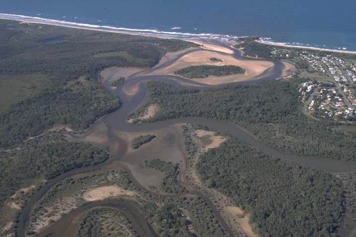
Aerial view of Corindi River
Local government management
Local councils manage estuaries within their area unless the estuary is attached to a marine park.
Corindi River estuary is managed by Coffs Harbour City Council. The estuary is located within the Solitary Islands Marine Park.
Threatened species
Corindi River estuary provides a stronghold for coastal saltmarsh, an endangered ecological community, on the north coast of New South Wales.
Estuaries provide important protected environments where native plants grow and create habitat for animals.
Read more about the biodiversity in our estuaries.