Deep Creek estuary is a medium-sized lagoon with an intermittently closed entrance. Located north of Nambucca Heads on the north coast of New South Wales, the estuary is typically open to the sea via a shallow constricted entrance.
Historically, artificial entrance opening has occurred at Deep Creek estuary when the lagoon has closed. The lower estuary supports a large area of tidal flats, mangroves and saltmarsh, and is a popular fishing and swimming spot.
Water quality report card
As part of our water quality monitoring program we assess the water quality and ecosystem health of an estuary using a range of relevant indicators. We sample a subset of the estuaries located between the Queensland border and Taree every 3 years. The most recent sampling in Deep Creek was completed over the 2018–19 summer, when 2 sites were sampled on a monthly basis.
This report card represents 2 water quality indicators that we routinely measure: the amount of algae present and water clarity. Low levels of these 2 indicators equate with good water quality.
Algae
Water clarity
Overall grade
The report card shows the condition of the estuary was good with:
- algae abundance graded good (B)
- water clarity graded fair (C)
- overall estuary health graded good (B).
Grades for algae, water clarity and overall are represented as:
- A – excellent
- B – good
- C – fair
- D – poor
- E – very poor.
Go to estuary report cards to find out what each grade means, read our sampling, data analysis and reporting protocols, and find out how we calculate these grades.
We have monitored water quality in the Deep Creek since 2012. This table shows the water quality grades for this estuary over that time.
| Year | Algae | Water clarity | Overall grade |
|---|---|---|---|
| 2012–13 | B | C | B |
| 2015–16 | A | B | B |
Physical characteristics
| Estuary type | Lagoon |
|---|---|
| Latitude | –30.6 (ºS) |
| Longitude | 153.01 (ºE) |
| Catchment area | 89.8 km2 |
| Estuary area | 1.7 km2 |
| Estuary volume | 1387 ML |
| Average depth | 1.3 m |
Tidal exchange volume
Tidal exchange volume or tidal prism data is available for this estuary. This tidal prism was measured in 2002.
| Tide state | Flow (ML) | Local tidal range (m) | Sydney Harbour tidal range (m) |
|---|---|---|---|
| Ebb flow | 220 | 0.25 | 1.67 |
| Flood flow | 280 | 0.28 | 1.72 |
Notes: km2 = square kilometres; m = metres; m3 = cubic metres; ML = megalitres.
Water depth and survey data
Bathymetric and coastal topography data for this estuary are available in our data portal.
Land use
The Deep Creek catchment is highly disturbed. Most land-use change has been driven by grazing and horticulture throughout the valley. A lot of the low-lying area adjacent to the estuary and the steep upper reaches of the catchment remain as forest, making up most of the total catchment area.
National and marine parks
- Bollanolla Nature Reserve is the largest conservation area within the Deep Creek catchment.
- This estuary does not flow into a marine park.
Community involvement
- Nambucca Valley Landcare provides workshops and volunteer work opportunities around the Nambucca Valley region, including Deep Creek.
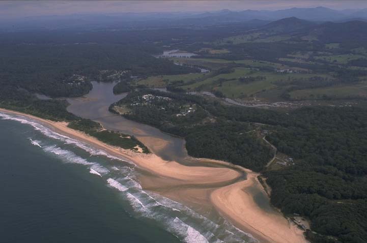
Aerial view of Deep Creek estuary
Local government management
Local councils manage estuaries within their area unless the estuary is attached to a marine park.
Deep Creek estuary is managed by Nambucca Shire Council. More information about estuary management is available on the council’s Coast and estuary management webpage.
Threatened species
The Deep Creek catchment is part of a vital stronghold for the endangered giant barred frog.
Read more about the biodiversity in our estuaries.