Darkum Creek estuary is situated in the township of Mullaway on the north coast of New South Wales.
The entrance of the estuary is intermittently closed/open to the sea and is classed as a creek.
Water quality report card
As part of our water quality monitoring program we assess the water quality and ecosystem health of an estuary using a range of relevant indicators. We sample a subset of the estuaries located between the Queensland border and Taree every 3 years. The most recent sampling in Darkum Creek was completed over the 2021–22 summer, when 2 sites were sampled on a monthly basis.
This report card represents 2 water quality indicators that we routinely measure: the amount of algae present and water clarity. Low levels of these 2 indicators equate with good water quality.
Algae
Water clarity
Overall grade
The report card shows the condition of the estuary was fair with:
- algae abundance graded good (B)
- water clarity graded poor (D)
- overall estuary health graded fair (C).
Grades for algae, water clarity and overall are represented as:
- A – excellent
- B – good
- C – fair
- D – poor
- E – very poor.
Go to estuary report cards to find out what each grade means, read our sampling, data analysis and reporting protocols, and find out how we calculate these grades.
Coffs Harbour City Council, in collaboration with the University of New England’s EcoHealth Program, has carried out detailed ecosystem health monitoring in Darkum Creek. The results of the monitoring program, including a detailed water quality report card, are available on the Coffs Harbour City Council website.
We have monitored water quality in the Darkum Creek since 2012. This table shows the water quality grades for this estuary over that time.
| Year | Algae | Water clarity | Overall grade |
|---|---|---|---|
| 2012–13 | A | C | B |
| 2015–16 | A | B | B |
| 2018–19 | B | C | C |
Physical characteristics
| Estuary type | Creek |
|---|---|
| Latitude | –30.1 (ºS) |
| Longitude | 153.2 (ºE) |
| Catchment area | 6.1 km2 |
| Estuary area | 0.1 km2 |
| Estuary volume | 16.5 ML |
| Average depth | 0.3 m |
Notes: km2 = square kilometres; m = metres; ML = megalitres.
Water depth and survey data
Bathymetric and coastal topography data for this estuary are available in our data portal.
Land use
Darkum Creek drains a highly disturbed catchment. Less than a quarter of the catchment remains as forest. Most of the land use here has been modified for banana and blueberry farms and urban development. There is also a golf course which adjoins Darkum Creek.
National and marine parks
- Darkum Creek is situated within Coffs Coast Regional Park.
- Darkum Creek is part of the Solitary Islands Marine Park.
Community involvement
- Coffs Harbour Regional Landcare provides workshops and volunteer work opportunities along the Coffs Coast.
- There are 22 bushcare and landcare groups in the Coffs Harbour area, including in Mullaway. These groups mainly work within the Coffs Coast Regional Park. For more information go to the National Parks and Wildlife Service Coffs Harbour bushcare and landcare webpage.
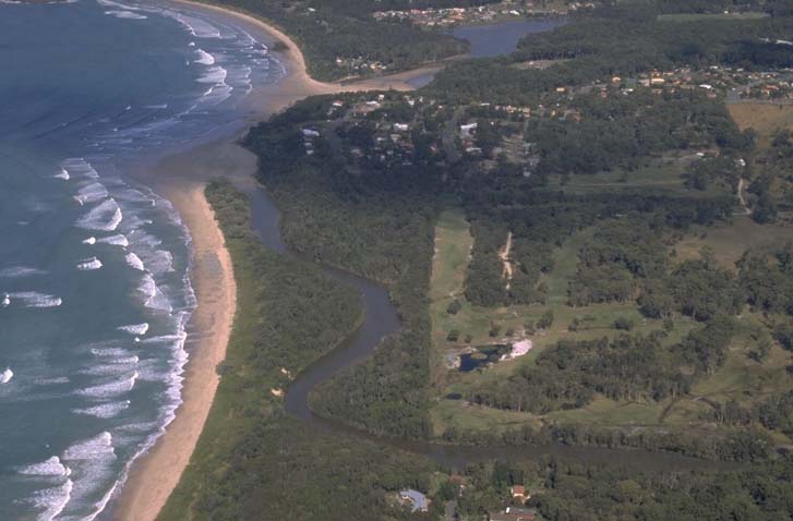
Aerial view of Darkum Creek estuary
Local government management
Local councils manage estuaries within their area unless the estuary is attached to a marine park. Darkum Creek is managed by Coffs Harbour City Council and the Solitary Islands Marine Park.
The Darkum Creek Estuary Coastal Zone Management Plan and Estuary Management Study Darkum Creek are available on the council’s website.
Threatened species
Littoral rainforest in the NSW north coast, which is listed as an endangered ecological community, exists adjacent to Darkum Creek estuary.
Read more about the biodiversity in our estuaries.