Nambucca River is situated on the mid-north coast of New South Wales. It is a large barrier river type estuary with an open, trained entrance.
Taylors Arm is a major tributary of the Nambucca River, converging just upstream of Macksville, and Warrell Creek flows into the main channel beside the entrance.
The estuary supports a range of mangrove, saltmarsh and seagrass communities and is a popular site for recreational fishing, boating and swimming. Commercial oyster farming and fishing also occur in the estuary.
Water quality report card
As part of our water quality monitoring program we assess the water quality and ecosystem health of an estuary using a range of relevant indicators. We sample a subset of the estuaries located between the Queensland border and Taree every 3 years. The most recent sampling in Nambucca River was completed over the 2018–19 summer, when 2 sites were sampled on a monthly basis.
This report card represents 2 water quality indicators that we routinely measure: the amount of algae present and water clarity. Low levels of these 2 indicators equate with good water quality.
Algae
Water clarity
Overall grade
The report card shows the condition of the estuary was good with:
- algae abundance graded good (B)
- water clarity graded good (B)
- overall estuary health graded good (B).
Grades for algae, water clarity and overall are represented as:
- A – excellent
- B – good
- C – fair
- D – poor
- E – very poor.
Go to estuary report cards to find out what each grade means, read our sampling, data analysis and reporting protocols, and find out how we calculate these grades.
We have monitored water quality in the Nambucca River since 2009. This table shows the water quality grades for this estuary over that time.
| Year | Algae | Water clarity | Overall grade |
|---|---|---|---|
| 2009–10 | A | C | B |
| 2012–13 | A | A | A |
| 2015–16 | B | B | B |
Physical characteristics
| Estuary type | Barrier river |
|---|---|
| Latitude (ºS) | –30.65 |
| Longitude (ºE) | 153.01 |
| Catchment area (km2) | 1298.9 |
| Estuary area (km2) | 12.6 |
| Estuary volume (ML) | 23,227.1 |
| Average depth (m) | 2 |
Tidal exchange volume
Tidal exchange volume or tidal prism data is available for this estuary. This tidal prism was measured in 1999.
| Tide state | Flow (ML) | Local tidal range (m) | Sydney Harbour tidal range (m) |
|---|---|---|---|
| Ebb flow | 5,240 | 0.64 | 1.18 |
| Flood flow | 3,960 | 0.68 | 1.12 |
Notes: km2 = square kilometres; m = metres; m3 = cubic metres; ML = megalitres.
Water depth and survey data
Bathymetric and coastal topography data for this estuary are available in our data portal.
Land use
Around one-third of the Nambucca River catchment is disturbed by land-use changes. The western half of the Nambucca River catchment largely comprises forested ranges up to the Great Dividing Range. Much of the land in the lower valleys has been modified for grazing and rural residential development. Major towns in the Nambucca River catchment are Nambucca Heads, Macksville and Bowraville.
Web cam
The Nambucca Heads bar crossing web camera provides real-time video of conditions within the river entrance immediately offshore to help with bar crossings and boat safety.
National and marine parks
- The adjoining Gumbaynggirr National Park, Gumbaynggirr State Conservation Area and Dunggir National Park form the largest conservation area within the Nambucca River catchment.
- This estuary does not flow into a marine park.
Community involvement
- Nambucca Valley Landcare provides workshops and volunteer work opportunities to regenerate and better manage natural resources around the Nambucca Valley region.
Seafood harvest area status
The NSW Food Authority website lists the current status of oyster/shellfish harvest areas.
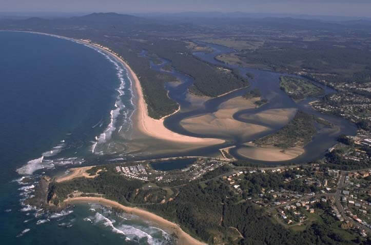
Aerial view of Nambucca River estuary.
Local government management
Local councils manage estuaries within their area unless the estuary is attached to a marine park. Nambucca River is managed by Nambucca Shire Council. More information about this estuary can be found on the council’s Coast and estuary management webpage.
Threatened species
Many threatened species can be found in the Nambucca River catchment, including the sphagnum frog and the stuttering frog.
Find out more about the biodiversity in our estuaries.